Geodetic News
|
FAA issues notice of GPS interference testing
|
| Monday, May 6, 2024 |
The Federal Aviation Administration (FAA) has issued the following notice of GPS interference testing that may result in unreliable or unavailable GPS signal:
|
|
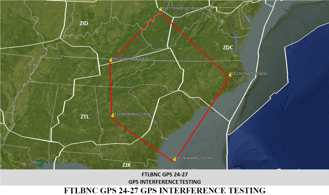
FLIGHT ADVISORY GPS INTERFERENCE TESTING
FORT LIBERTY NORTH CAROLINA (FTLBNC) 24-29 and 24-27
08 - 09 May / Fort Liberty, NC
|
|
Please note that this particular test is not the typical GPS interference test that is centered at a point and impacting an expanding radius with increasing elevation like an upside-down truncated cone. Rather, this test will impact the following area from the surface to UNL (altitudes greater than 99,900FT):
|
|
In addition, the FAA emailed out and posted two notices for this test (FTLBNC 24-29 and FTLBNC 24-27), but with different non-overlapping time periods. The combined schedule is as follows:
- 08 MAY 24: 1801Z – 2059Z
- 09 MAY 24: 0001Z – 0259Z, 0330Z – 0630Z, and 1501Z – 1859Z
|
NC Geodetic Survey CORS fund donation page now live
|
| Wednesday, April 17, 2024 |
|
Those wishing to donate to the NCGS CORS fund may do so at the link below.
|
|
|
|
This link is also accessible via the CORS/GNSS page.
|
|
Geodetic News Archive
|
|
Geodetic news items older than approximately 6 months (unless deemed critical) as well as expired GPS interference testing notices can be found on the news archive page at the link below.
|
|
|
|
Real Time Network Sensor Map
|
|
To view the real time network sensor map please visit the link below.
|
|
|
|
Beta NGS Map
|
|
In the event that the NCGS Geodetic Control Database is unavailable, users may find the Beta NGS Map, accessible at the link below, a useful alternate resource.
|
|
|